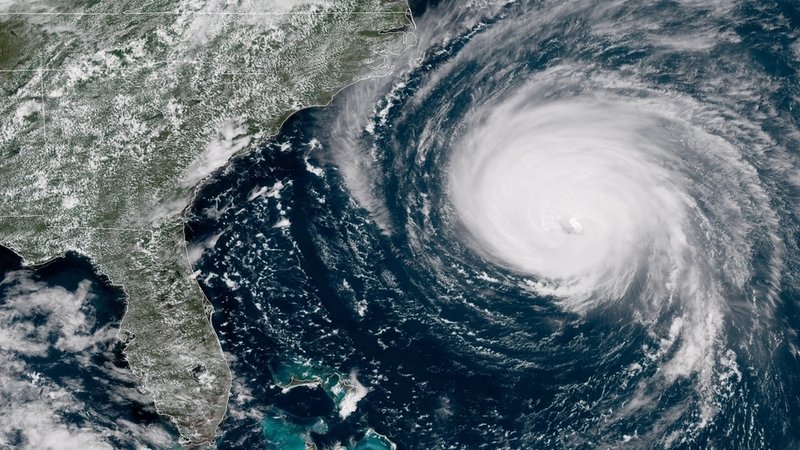
17 Sep Drones Aid During Hurricane Florence Aftermath
Hurricane Florence battered the East Coast last week and water is still rising. During the storm, most people went to their car to charge their phone to check the news and social media. Many people were able to see the damage and flooded areas thanks to drones. Drones are now aiding in Hurricane Florence disaster relief by showcasing the most damaged and flooded areas from the sky.
However, drones aren’t just used for capturing footage. A small army of drones is being assembled to quickly help identify and even fix damage caused by the storm.
At least 53 drone teams have been recruited to help with damage assessment. Each team usually brings more than one drone and the force collectively includes about 100 to 160 operators.
The numbers may seem small compared with the roughly 40,000 utility workers mobilized to provide assistance, but drones can provide faster access to find problems in flooded or otherwise dangerous areas. Local providers including Duke Energy Corp. and Southern Co. are utilizing aerial equipment fitted with infrared and high-zoom sensors that can inspect substations, locate malfunctioning solar panels and even help to restring power lines.
Insurers are also using drones to inspect properties and collect evidence for claims after the storm has passed. As drones technology gets more and more advanced, we can thank them for being utilized to help so many people that are in dire need right now.
Wilmington, NC is currently inaccessible by land and all food is going to be delivered by air. When it comes to situations like this, drones come to the rescue.
Not everyone can operate a drone! Here at V-drone, we know what we are doing. We have the latest in drone photography technology. Our aircraft can capture everything from stills to 4K footage at heights of up to 400 ft. They are equipped with live camera view and GPS positioning, which allows us to frame up your shot at the precise altitude you request. With multiple drones, employing multi-camera setups, we can create 360-degree views and high-resolution images with no lens distortion.
No Comments