03 Jan Drones and Natural Disasters
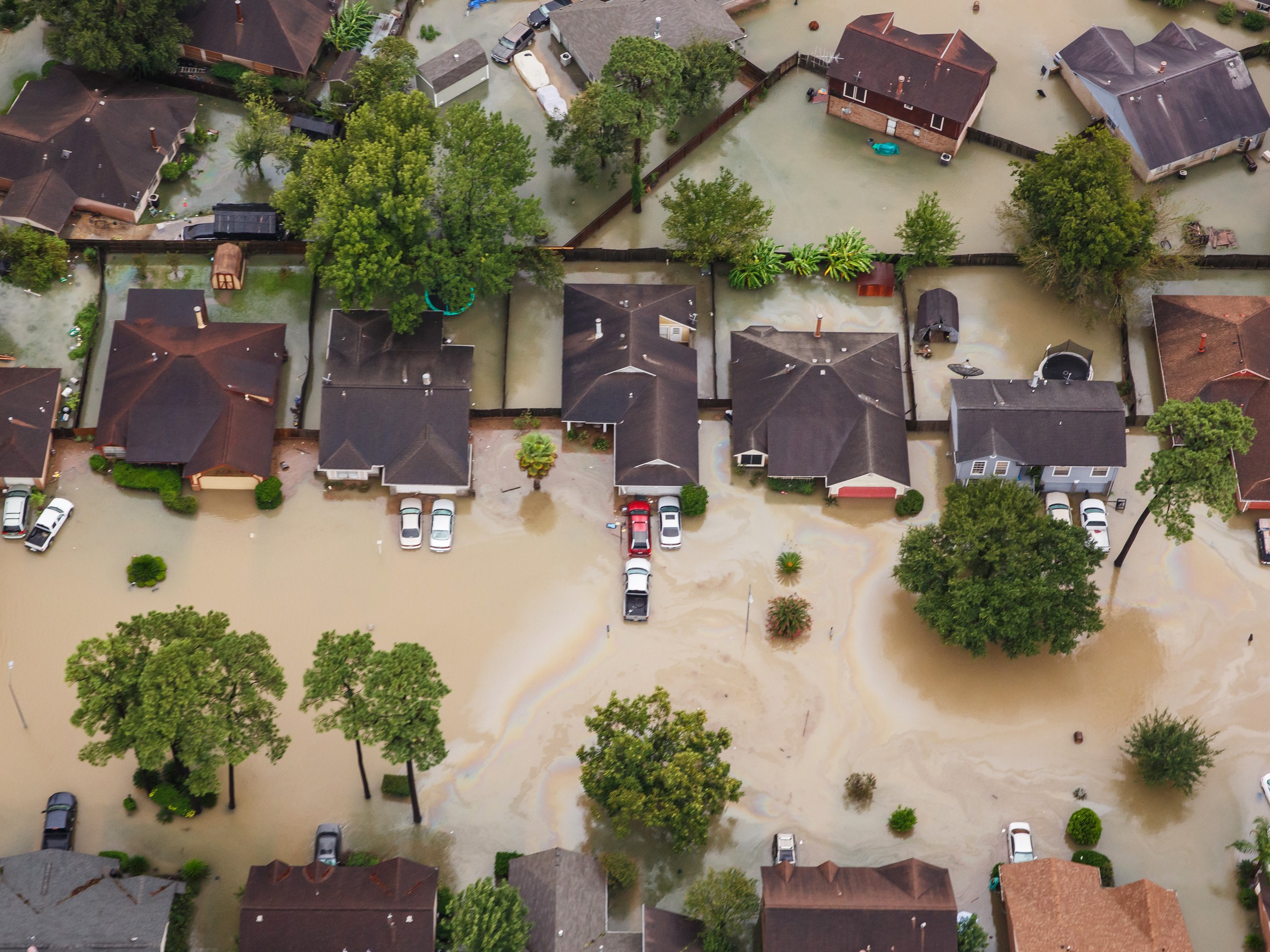
There’s a lot to be said about drones and natural disasters. 2017 was a year that many of us in the US watched natural disasters devastate parts of the country. If anything, this past year has taught us that we are stronger together and that even the worst natural disasters are not enough to stop the resilience of people. Most of the footage that those of us on the outside of these disasters watched were filmed with one of today’s most useful machines: the drone. However, the drone helped in more ways than you could imagine this past year. Here are the ways that drones helped in the recovery process after Hurricane Irma and Harvey.
In the days after Hurricane Harvey, the Federal Aviation Administration issued 137 airspace authorizations for drone-related recover efforts in the Houston area. Shortly after, the FAA issued 132 airspace authorizations in the Florida area after Hurricane Irma. Hundreds of drones were used for hurricane recovery efforts: for surveys, helping with insurance claims, restoring power, and more.
Search and Rescue
In Houston, a team from Texas A&M University flew 119 drone flights in eight days between Aug. 25th and Sep. 4th. These drones monitored levees and measured damage in addition to spotting people in need and rescuing them during this difficult time.
Media Coverage
ABC and CNN aired drone footage to show viewers what the areas looked like before and after the storm. This spread awareness to the actual devastation by giving viewers a birds-eye view of the landscape. Since people were able to see the effect of the storm, more and more people and companies pitched in to help financially, resourcefully, and emotionally.
Surveying
The National Guard used drones to perform an aerial survey to show an aerial view of the disaster and determine which areas needed to be prioritized for assistance.
Mapping
The U.S Customs and Border protection used drones to map areas in Key West, Miami, and Jacksonville. This allowed them to inspect infrastructure such as power plants for the federal emergency management agency.
Railroads
The Texas railroad company used drones to survey damage along a major rail line.
Insurance
This is a really important one. Airbus Aerial is using drones to help insurance companies handle insurance claims. Airbus Aerial technology allows insurers access to its archives of data to see what a given area looked like before a storm. These drones can gather data, and paired with manned aircraft and satellite data can give an image of sites before and after the hurricane. This helped insurance companies prioritize the hardest hit areas and efficiently deploy their on-site adjusters to the places they were needed most.
Power Restoration
The Jacksonville Electric Authority in Florida used drones to restore power after severe outages that affect 6 million residents. Within 24 hours of the storm, these drones were able to assess the damage.
Drones are becoming an integral part of disaster relief efforts. The view from above is key for humanitarian response, which explains why satellite imagery has played a pivotal role in relief operations for almost two decades now. Here at V-drone, we are strong proponents of community-centered approaches to humanitarian resources. A community is key when it comes to recovery after a disaster. From all of us here at V-drone, we hope that you all have a safe and Happy New Year and that everyone has learned how to remain strong no matter what life throws at us. Goodbye 2017, and welcome 2018!
No Comments